Showing posts with label Gonokawa. Show all posts

Tuesday, April 9, 2024

Sakurae Koinobori


Early May, 2013, and I start day 6 of my walk along the Kannon pilgrimage in the former province of Iwami, the Iwami Mandala Kannon. The last temple I visited was Senganji upriver in Kawamoto and the next two temples lie between it and my home so I decided to start out from my house and walk this section in reverse as it were.


The azaleas were starting to bloom and a few houses had koinobori carp streamers flying.


The colourful bridge that crosses the river between Tanijyugo, my village, and Kawado on the opposite bank, had recently had a new coat of paint.


Just upstream from the Kawado Bridge, two lines of koinobori are stretched across the river.


On the far bank is where the local suijin festival will take place on May 5th. A large Onusa, a purification wand, hangs over the river at this point to pacify the turbulent water deity.


The previous post in this series was Senganji Temple. Also please check out this post about the water deity Suijin.


Sunday, March 17, 2024

Along the Gonokawa River to Kawagoe


After leaving the riverside fields of Tazu, the road heads about half a kilometer sandwiched between the forest and the river until the land opens up again in Kawagoe.


This was the next stop on the train after Tazu, and Kawagoe has a post office and used to have an elementary school. A road runs inland up into the mountains.


The bridge across the river is relatively new. When we first moved here the old bridge was still being used, but in the first few years a new one was built and the old one was demolished.


There is a small shrine in this first part of Kawagoe. It is unusual in that it has no kagura group. Back in a major flood in the 1960's all the costumes and masks were destroyed, and the cost to replace them was simply too high.
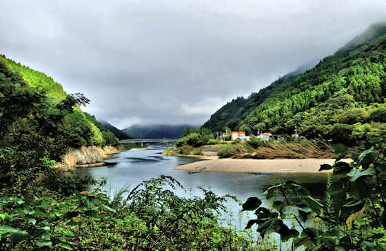

I continue on along the top of the embankment that separates the river from the strip of agricultural land that continues on to the next settlement of Wataru.


The previous post in this series documenting my walk along the Gonokawa River was on Tazu.


Thursday, January 18, 2024

Tazu


Tazu is a small farming community on the Gonokawa River. It is the next settlement upstream from Kawado.


It has no shop, nor post office, or school, but it does have a bridge and it did have a halt on the Sanko Line railway, though I never ever saw anyone get on or off here.


It is unusual in that the land usable for agriculture is relatively wide. A friend of mine is a burdock root farmer here though he has given up and moved because of a series of disastrous floods in recent years that destroyed his crop.


Some of the houses are still inhabited but I would guess close to half are empty and abandoned.


The previous post was on Kawado to Tazu.


On the way out of the village, the road was blocked. As usual, there were no warning signs that the road was closed ahead. Also as usual I walked around the barrier and carried on....


Saturday, November 11, 2023

Along the River to Tazu


The couple of kilometers of road along the bank of the Gonokawa River from Kawado to Tazu has no settlements or houses.


On the opposite bank, there is a main road and plenty of settlements but on this side, the steep mountainside runs straight down to the river.


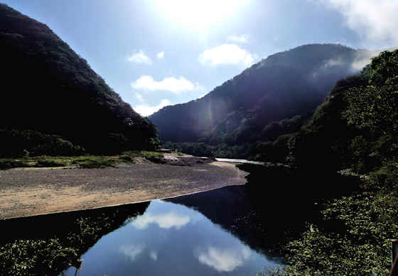
This bank is usually dark. Even in the summer the sun does not get above the mountain until late in the morning, and in winter the sun doesn't penetrate the tree cover at all. On the opposite bank, the sun continues to burn off the mist that fills the river valley at this time of the year (early October)


The narrow road and abandoned rail line run next to each other on a narrow shelf cut into the mountainside using very little machinery. At times the train line passes through short tunnels.


The Gonokawa is the longest river in the Chugoku region at 194 kilometers, but geologically speaking it is relatively new so the river valley is mostly narrow.


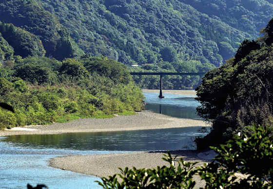
This used to be such a beautiful train ride, but is still a very pleasant walk as there are only 1 or 2 cars a day. Up ahead I catch a glimpse of the Tazu Bridge, a small affair unsuitable for anything bigger than small delivery vans.


The previous post was on the first part of this leg of my walk along the Gonokawa, around Kawado.


Tuesday, September 12, 2023

Around Kawado on the Gonokawa River


I begin the second leg of my walk up the Gonokawa River to its source from my home. I live on the other bank to the one I am walking up. My plan is to later walk down the river from the source to the sea on this other bank. Looking across the river you can see a section of the river that has no road on that bank, hence my reason for starting this leg here, rather than Kawahira where I finished the first leg.


Behind me is my village.


Across from my village is where te Yato River enters the Gonokawa. This is a decent-sized tributary with a dam and reservoir and it starts up in the mountains around the ski resorts of Mizuho. The bridge carries the now closed rail line, the Sanko sen that used to follow the river all the way up to Miyoshi in Hiroshima.


On the walk up to the bridge that crosses over to Kawado I pass by the big sacred tree where Tanijyugo has their giant Onusa, purification wand, that pacifies the turbulent water god of the river.


The bridge that crosses the river to Kawado is painted in a very distinctive colour scheme that , I believe, represents the river, the sjy, and cherry blossoms. Not sure when the bridge was built. There was a major flood of Kawado back in the 1960's so it certainly postdates that. I have seen an old photos of a low wooden bridge in the 1920's, but for most of history the on,y wa to cross was by ferry.


Now protected, somewhat, by a high embankment, Kawado used to be the main town of the area. The large building is a traditional soy sauce brewery.


On top of the cliff at the first bend in the river is the Kawado suijin Onusa. This is the biggest one in the area and the main focus of the local Suijin Matsuri.


Looking upstream, that house is the only habitation in the several kilometers between Kawado and Tazu.


Kawabune, a generic term for riverboats. Traditionally made of wood, aluminum, and fibreglass are now more common, as are small outboard motors. I am guessing they are primarily used for fishing for Ayu, sweetfish, similar to trout. Larger, flat-bottomed boats were used for freight.


Looking back downstream to the Kawado Bridge. This next section of the road has no buildings and very little traffic, the main road being on the opposite bank, as it is for most of the river. The rail line is overgrown.

Thursday, July 6, 2023

Kawahira


Walking up the right bank of the Gonokawa, Kawahira is the first main inlet coming into the river. From Kawahira the road heads into the mountains and then forks with the older road heading into Gotsu from behind, and the newer road heading further inland to Atoichi and onto Arifuku.


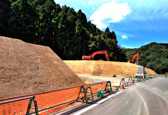
One section of Kawahira has been completely re-engineered and raised several metres, ostensibly to prevent flooding. Lots of free, new houses for the few residents remaining, and of course lots for the construction and concrete companies. Kawahira no longer has any shops but it does hve a Post Office and a Koban, a rural police box.


It also had the first proper station on the closed Sanko Line. The other two stops between here and Gotsu, Chigane, and Gotsu Honmachi, were just "halts", platforms with a small shelter, whereas Kawahira has a building, toilets, and what used to be a ticket office.


Kawahira has the first bridge across the Gonokawa after those at its mouth in Gotsu. Though my plan is to walk up the right bank I have to cross the river at this point to the left bank. From here up to Kawado, there is no road on the right bank, the only section along the whole river. The rail line is on the right bank, and back when it ran the trains were so infrequent that I have walked along the line several times in this section, but since the line closed down the tracks have become choked with undergrowth and its no longer possible to walk it.


Ive been to the main shrine in Kawahira several times for matsuri to watch kagura, and one time to watch  Omoto Kagura, the shamanic form that only survives in this area of Japan, but the most common reason to visit Kawahira is for the Tauebayashi, the rice-planting festival.


As my plan is to explore the left bank by walking downstream from the source, I hop on a bus and plan the next leg from Kawado on up. The previous post in this series "To The Source" was To Kawahira

Monday, May 1, 2023

To Kawahira


At the far end of Tanomura, the almost-deserted settlement on the right bank of the Gonokawa River, is a small shrine hidden back where the former farmland meets the hillside, the kind of location where people built their homes. According to  Google Maps, it is no longer marked as a shrine. Not sure what criteria they are using, but the shrine still stands but has probably not seen a ceremony in quite a few years.


It was an Omoto shrine I believe, and the doors were unlocked, something normal for shrines in the countryside I think. The structure hanging from the ceiling is a tengai, under which kagura was performed. About 6 to 8 years ago I stopped in and everything was just about as it is now. Probably there were a few more inhabitants back then. Not sure what the Japanese equivalent of deconsecration is, but the shrine may not have been used, but is still technically a shrine, so I find google maps to be less and less accurate and truthful


It's about halfway between what used to be the previous and next stations and I doubt anyone from Tanomura ever used the train in the past twenty years.


From here there are no settlements until Kawahira. No solitary farmhouses or isolated rice paddies. The narrow road and former train line cling to the edge of the steep slopes.


On the opposite bank, there is a main road and a lot more settlements. Also, lots of construction work building up embankments and raising the level of the road to counter the increasing floods Quite a lot of brand new houses are built to replace those demolished for the "improvements".


About twenty years ago I floated down the river on a Dragon Boat and from down at the waters level you could barely ever see the roads or any man-made structures...... I think the new construction is changing that.


Before coming into Kawahira a small roadside Buddhist shrine......... It has seen better days, but someone comes from some distance away sometimes to give it a sweep and to add green offerings..... i suspect a very elderly person, and in all likelihood when they pass away there will be no one left to remember the story and history behind this little altar


The previous post in this series following my walk up the Gonokawa River to its source was Around the Next Bend.